Reproduced with permission from ref 1© 2016 John Wiley and Sons.
Red Sea climate data covering the period between 2000 and 2014 has been reconstructed highly accurately at smaller time and space intervals than ever before by KAUST researchers, who used an advanced numerical weather modeling system that incorporates all weather data from the region.
The system, called the Advanced Research version of Weather Research and Forecasting (WRF-ARW), was developed by the United States National Centers for Environmental Prediction to reconstruct and forecast weather data based on current conditions.
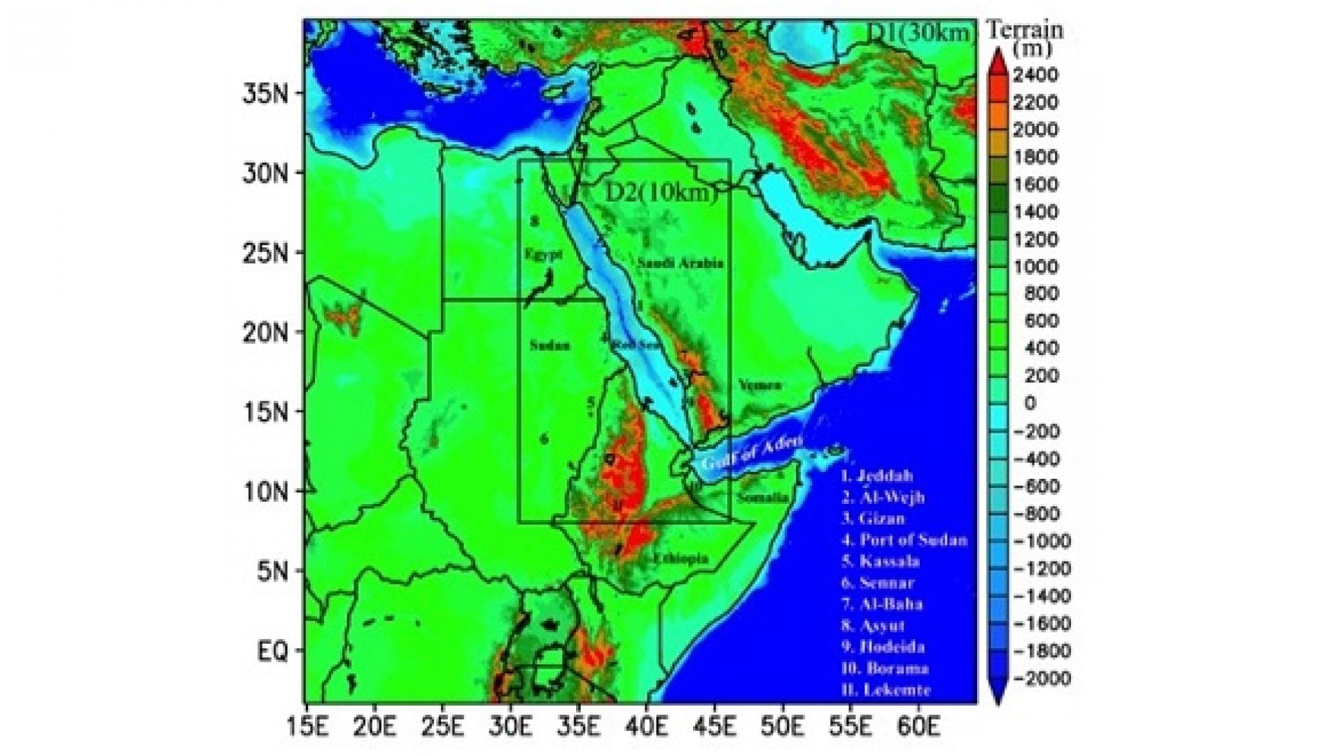
Ibrahim Hoteit, Associate Professor of Earth Science and Engineering at KAUST, and his colleagues took advantage of the advanced computational facilities at the University to customize the system and generate high-resolution regional climatic data covering relatively small timescales and geographic areas over the Red Sea. To do this, they combined low-resolution global reconstructed climatic data covering relatively large geographic areas and timescales with available satellite and in situ observations over the region.
“The study generated and validated much-needed high-resolution atmospheric and wave datasets for the Red Sea and adjoining region,” noted Hoteit. “These high resolution datasets more accurately describe the regional climatic features of this region than available global products.”
Read the full article
Related Persons