Using Unmanned Aerial Vehicles (UAVs) to enhance network coverage has proven a variety of benefits compared to terrestrial counterparts. One of the commonly used mathematical tools to model the locations of UAVs is stochastic geometry (SG).
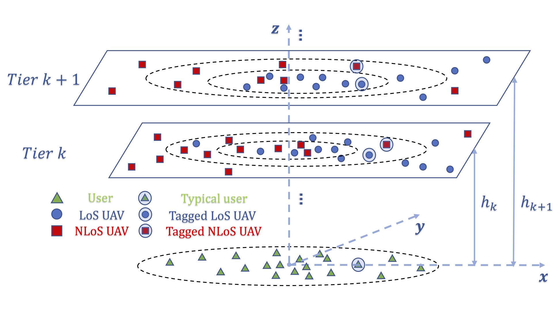
CTL researchers considered an inhomogeneous Poisson point process (PPP)-based model for the locations of the users that captures the degradation in the density of active users as users move away from the town center. The deployment of aerial vehicles following the same inhomogeneity of the users was proposed to maximize the performance. In addition, a multi-tier network model was also considered to make better use of the rich space resources.
CTL researchers derived the analytical expressions of the coverage probability for a typical user and the total coverage probability. They optimized the coverage probability with limitations of the total number of UAVs and gave the optimal UAV distribution parameters when the maximum overall coverage probability is reached.
More information can be found in the video given below and the paper:
R. Wang, M.A. Kishk and M. -S. Alouini, "Resident Population Density-Inspired Deployment of K-tier Aerial Cellular Network", IEEE Transactions on Wireless Communications, 2023
Related Persons