About Neil Smith Neil Smith Research Scientist, Computer Science Scientific Visualization Computer Vision UAV Neil Smith is a Research Scientist in the Computational Imaging Group (VCCIMAGING) working with Professor Wolfgang Heidrich at King Abdullah University of Science and Technology (KAUST). Education and Early Career Neil joined University of California in San Diego (UCSD) at the start his academic journey. He obtained his bachelor degree in Anthropology with Concentration in Archaeology in 2001. After that in 2003, he received his master degree in Anthropology. He has a doctoral in Anthropology since 2009. Dr. Smith started his career life as a Geographic Information Systems (GIS) Specialist at Articles Related News October 2018 Aerial Path Planning for Urban Scene Reconstruction: A Continuous Optimization Method and Benchmark 1 min read · Tue, Oct 16 2018 News optimization urban planning Small unmanned aerial vehicles (UAVs) are ideal capturing devices for high-resolution urban 3D reconstructions using multi-view stereo. Nevertheless, practical considerations such as safety usually mean that access to the scan target is often only available for a short amount of time, especially in urban environments. It, therefore, becomes crucial to perform both view and path planning to minimize flight time while ensuring complete and accurate reconstructions. In this work, we address the challenge of automatic view and path planning for UAV-based aerial imaging with the goal of urban February 2015 A breeding ground for successful start-ups 1 min read · Fri, Feb 6 2015 News visualization quadcopter State-of-the-art facilities and world-class research projects give rise to thriving start-up companies based at KAUST. September 2014 5 Year Anniversary Showcase 1 min read · Wed, Sep 3 2014 News There were over 15 faculty members that helped, dedicated there time, and worked together to create an experience that everyone could enjoy. With effort, creativity, passion, collaboration, and dedication these faculty members made this whole event possible!
Aerial Path Planning for Urban Scene Reconstruction: A Continuous Optimization Method and Benchmark 1 min read · Tue, Oct 16 2018 News optimization urban planning Small unmanned aerial vehicles (UAVs) are ideal capturing devices for high-resolution urban 3D reconstructions using multi-view stereo. Nevertheless, practical considerations such as safety usually mean that access to the scan target is often only available for a short amount of time, especially in urban environments. It, therefore, becomes crucial to perform both view and path planning to minimize flight time while ensuring complete and accurate reconstructions. In this work, we address the challenge of automatic view and path planning for UAV-based aerial imaging with the goal of urban
A breeding ground for successful start-ups 1 min read · Fri, Feb 6 2015 News visualization quadcopter State-of-the-art facilities and world-class research projects give rise to thriving start-up companies based at KAUST.
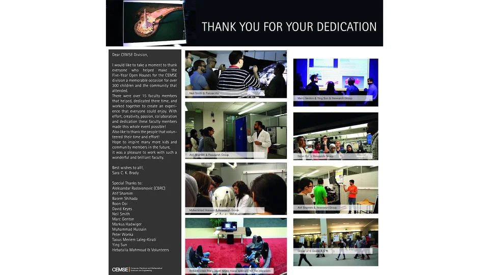
5 Year Anniversary Showcase 1 min read · Wed, Sep 3 2014 News There were over 15 faculty members that helped, dedicated there time, and worked together to create an experience that everyone could enjoy. With effort, creativity, passion, collaboration, and dedication these faculty members made this whole event possible!
Related Sites Computer Science (CS) Computational Imaging Group (VCCIMAGING) Related Content Articles 3 Related Links Also view list of Publications on KAUST Repository Computational Imaging Group (VCCIMAGING)