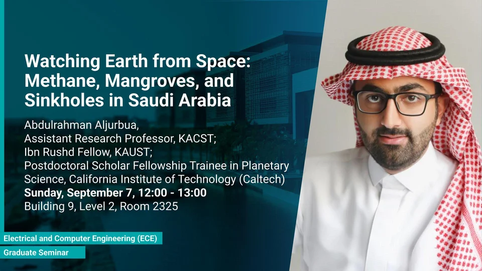
Monitoring Environmental Change in Saudi Arabia from Space: Methane Emissions, Mangrove Ecosystems, and Ground Deformation
Satellite remote sensing for environmental monitoring, climate studies and hazard assessment in Saudi Arabia.
Overview
Abstract
Satellite remote sensing is transforming our ability to monitor environmental processes across large geographic regions with unprecedented spatial and temporal coverage. In this seminar, Dr. Aljurbua presents recent advances from three ongoing research projects focused on Saudi Arabia. First, using data from NASA’s Earth Surface Mineral Dust Source Investigation (EMIT) mission, methane emission sources across the Arabian Peninsula are analyzed to investigate their spatial distribution and persistence. Second, synthetic aperture radar (SAR) and optical satellite observations are employed to map mangrove ecosystems and estimate their biomass, supporting efforts to quantify coastal blue-carbon resources. Third, interferometric SAR (InSAR) time-series techniques are used to detect and monitor subtle ground deformation associated with sinkhole activity and subsurface hazards near Riyadh. Together, these studies demonstrate how modern satellite observations, combined with signal processing and geospatial analysis, provide actionable information for environmental monitoring, climate studies, and hazard assessment in Saudi Arabia.
Note
A light lunch will be provided after the seminar.
Presenters
Abdulrahman Aljurbua, KAUST Ibn Rushd Postdoctoral Fellow, California Institute of Technology (Caltech)
Brief Biography
Abdulrahman Aljurbua is a KAUST Ibn Rushd Postdoctoral Fellow at the California Institute of Technology (Caltech) since August 2024.
He received his B.S. degree in Electrical Engineering from King Fahd University of Petroleum and Minerals in 2017, and his M.S. and Ph.D. degrees in Electrical Engineering from the University of Michigan, Ann Arbor, in 2020 and 2022, respectively under the supervision of Professor Kamal Sarabandi, where he developed inversion algorithms for detecting and localizing buried pipelines and leaks using a novel multistatic subsurface synthetic aperture radar (SAR) system.
His current research at Caltech focuses on satellite-based remote sensing, including InSAR for surface deformation monitoring, SAR for mangrove mapping and biomass estimation, and hyperspectral imaging for monitoring greenhouse gases.